Stormwater Asset Management
Nearly every community is dealing with large storm events occurring more frequently than ever. Localized flooding is occurring in some cases monthly rather than every few years as recent as only a decade or two ago. This means that asset management in stormwater systems is more important than ever and maintaining accurate and up to date information on stormwater infrastructure is vital to preserving the function of stormwater systems. Additionally, many communities are having to comply with EPA’s Municipal Separate Storm Sewer System (MS4) Permit that requires obtaining detailed information about the entire system, including catch basins, manholes, pipes, outfalls, and stormwater treatment structures. CEI’s asset management couples customized forms and reports directly into industry-standard ArcGIS for easy use by communities to help with stormwater system maintenance and upgrade projects.
Key Benefits
- Risk Reduction
Emergencies such as flooding can be minimized or avoided. Use asset management for stormwater to be informed of preventative maintenance to reduce the risk of disruptive emergency repairs. Document and resolve potential safety issues before they impact employees or the public. Ensure regulatory requirements are achieved.
- Cost Savings
Asset management are an ideal capital project planning tool, providing insights and evidence for future infrastructure capital expenditure. Reduce the cost of operations and capital expenditure using information about your stormwater assets age and performance. Reduce the number of high-cost emergency repairs.
- Knowledge in the Field
It’s common for decades of institutional knowledge be undocumented and reside in staff members memory. This can lead to operational blind spots, employee burnout, and difficulty onboarding. Easy and ongoing documentation of stormwater assets identifies areas of risk, regardless of employee tenure. It also identifies critical activities to focus maintenance activities. By democratizing asset maintenance information and providing key information to staff members in the field, they are empowered to be more effective in their role.
Solutions
- Combine all data together in one easy-to-access place using industry standard software, meaning results can be readily available to field staff
- Real-world structure location accuracy within inches; no more uncertainty about where structures are located
- Comprehensive survey-grade elevations of all relevant features
- Full condition assessment inside, outside, and around all structures
- Ability to do color-coded status, (e.g. recently maintained, maintenance needed, access issue, etc.)
- Develop customized infrastructure inspection reports over time mean you can be proactive to maintenance; not reactive
- Justify maintenance and capital funding as part of annual budget requests
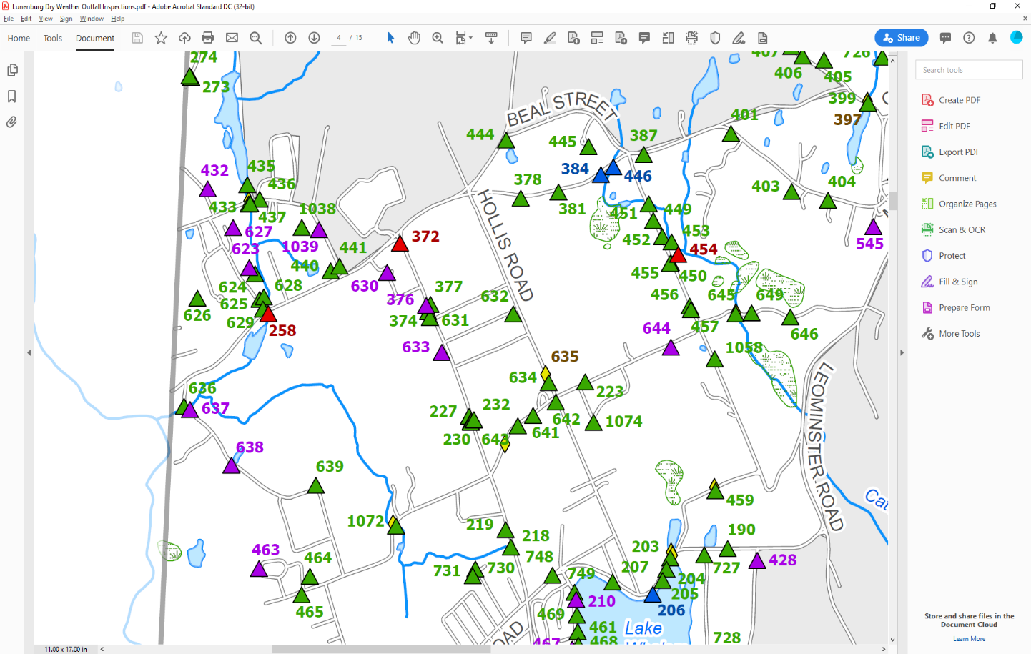
Case Study: Multiple MS4 Communities
CEI is currently assisting over 20 Massachusetts communities with implementing components of the 2016 Municipal Separate Storm Sewer System (MS4) Permit. The Permit requires extensive field work related to drainage infrastructure, including work related to inspecting stormwater outfalls during dry weather flows, determining sediment accumulation rates within catch basins, and completing annual inspections of stormwater BMPs such as infiltration and detention basins. CEI documents all work directly into ArcGIS using customized forms to record all data for use by the town, allowing for both immediate usage and the ability to track changes over time. Benefits to the community include:
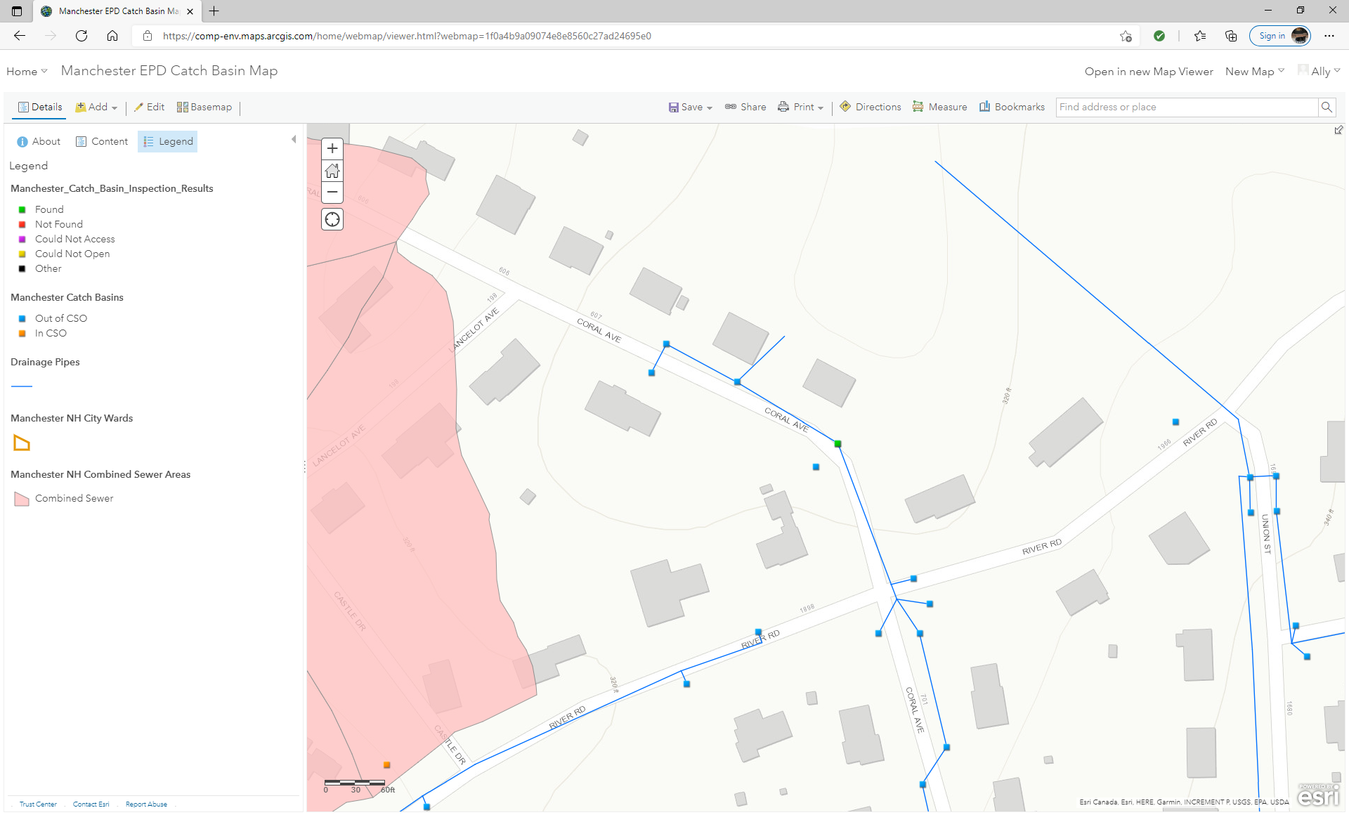
Catch Basins and Manholes
- Obtain comprehensive elevation data for rims, pipe inverts, and structure bottom
- Determine sump depth and structures with inadequate sumps
- Determine sediment depths
- Track illicit discharge indicators
- Multiple inspections allows for tracking sediment accumulation rates
- Capture data over time to develop an optimal catch basin cleaning schedule
- Help comply with MS4 by maintaining basin sumps at less than 50% full
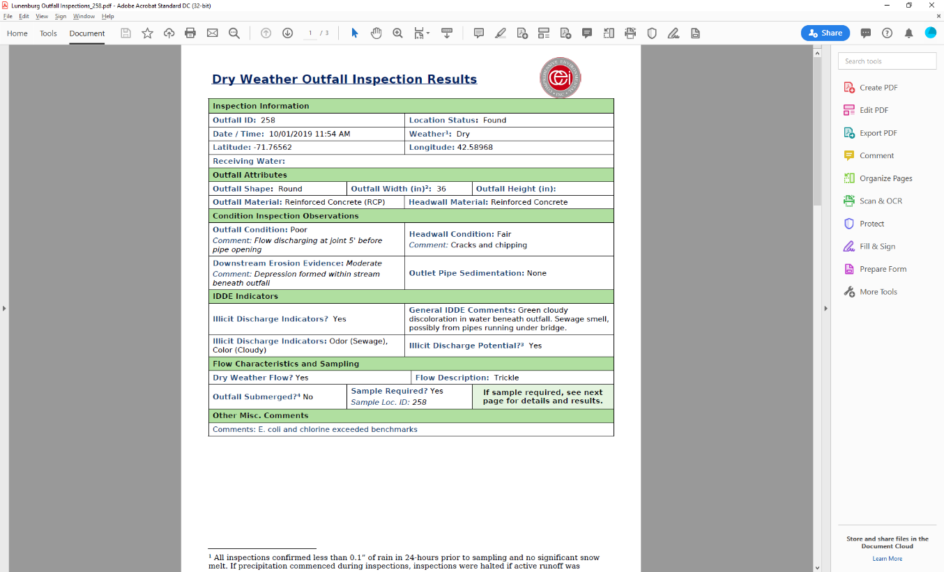
Outfalls
- Inventory outfall attributes, e.g. shape, dimensions, materials
- Record pipe sizes, inverts and slopes
- Complete condition assessment of outfalls, headwalls, downstream conditions
- Track illicit discharge indicators and follow-up actions
- Log dry and wet weather flow characteristics and sample results
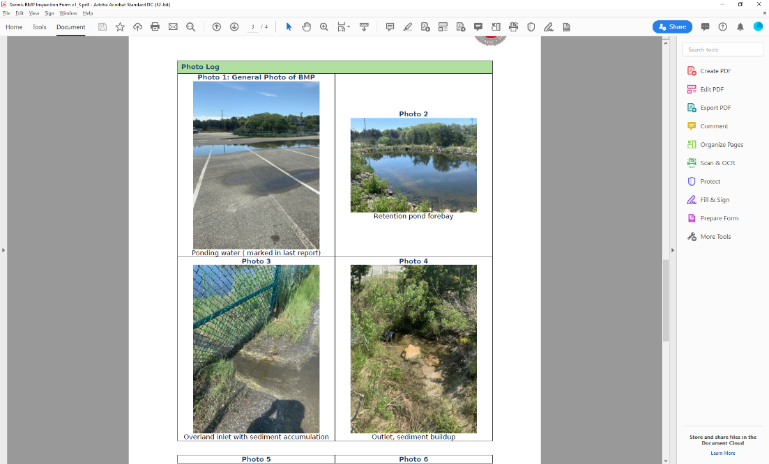
Treatment Structures / BMPs
- Log annual inspection results
- Track maintenance completed and maintenance needed
- Generate maintenance work order
- Generate custom reports in an easy to read format with photos, etc.